
China's Karakorum Highway
Three different countries. 25,000 foot mountains. Over two-thousand years of continual trade. Four different ethnic groups. $46 billion in infrastructure improvements. Camels and oxen. Lorries and motorcycles. What is this magical place? It's a highway. The Karakorum Highway, which links China to Pakistan (and nearby Tajikistan) through a corridor of foothills, slot canyons, sand dunes, glaciers, and snow-capped peaks. I got to spend a few days exploring it on a recent trip to China.
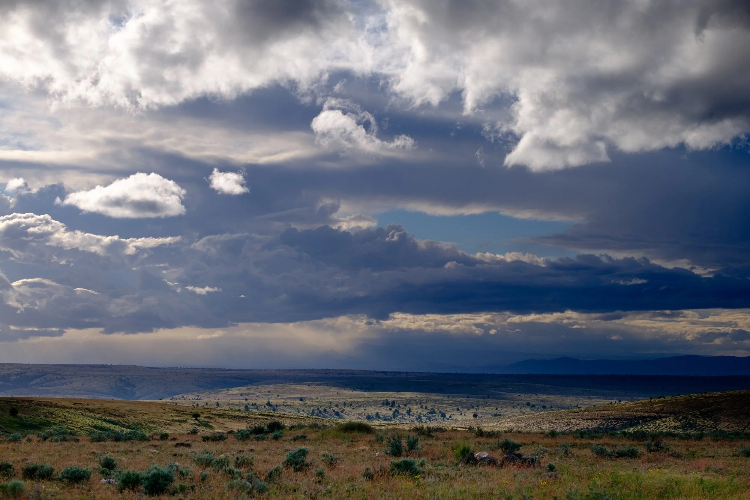
I spent 12 days vising two good friends from grad school who are on sabbatical in Xi'an, and they thought exploring China's far west would be a grand adventure. And it was! We stopped in Urumqi for a night on the way to Kashgar, and after a couple days exploring Kashgar we began the six-hour drive on the Karakorum Highway from Kashgar to Tashkurgan, the westernmost city in China (and less than 100 miles from the Pakistan border). While Tashkurgan -- a historic city at the nexus of trading of four trading routes into Pakistan, Tajikistan, and Afghanistan -- was the destination, it was the drive up that I was most excited about. We travelled on the Karakorum Highway, starting in the 4,167-foot oasis town of Kashgar at the nexus of two rivers and a massive desert. Tashkurgan -- elevation 10,151 feet -- is 181 miles to the south-west. Those 181 miles pass through slot canyons, above glacier-carved floodplains, around a 24,636-foot snow-capped mountain, nearby massive valley grasslands, and over a 13,336-foot mountain pass.
The Karakorum Highway passes through the Pamir Mountains, which are just north-west of the Tibetan Plateau. Quite young in geological age, they were formed by the Indian tectonic plate moving north and hitting the Eurasian plate. Unlike most tectonic plate collisions, neither the Indian nor the Eurasian plate subducted (went underneath the other one). This created the Pamir Mountains we were exploring, as well as the better-known Himalayas to the south.
In more recent times, the area became a strategic point along the Silk Road (which actually primarily traded in goods other than silk, and was more than one singular road). Starting around 2,000 years ago during the Han Dynasty, the multiple routes on the Silk Road connected China with India, Iran, Europe, Mesopotamia, and the like. The Southern Silk Road went on the exact route where the Korakorum Highway now goes, connecting China with Iran, Mesopotamia, and the Levant. Trade along this corridor has been continous for the past 2,000 years — aside from a war here and there — and China is investing in this corridor’s future as part of China’s Belt and Road Initiative. In the past decade China has spent $46 billion rebuilding and widening the Karakorum Highway. When we explored the route, lorries carrying goods to-and-from China frequently rushed by, just as their fore-fathers did decades and centuries and millenia before. Only now it’s on a nice two-lane paved highway.
One downside of the trip is that it involved lots of driving. I would have loved to travel the backroads by mountain bike or motorcycle, or the alpine valleys by backpack. Unfortunately the region is locked down for foreigners, with China requiring approved guides for travel past Kashgar, and police checkpoints are common. The area also isn’t the safest to travel off the beaten path, with Afghanistan less than 100 miles away and Tajikistan even closer, where four westerns on a biking adventure were killed by terrorists in 2018. So we hired a guide and driver, stayed in China portion of the route, and spent lots of time travelling by car.
I’m still left in awe about the region. Rarely do I travel to places that are both majestic and historic. Glacier National Park, Mt Rainier National Park, and the Swiss Alps contain similar majesty, but don’t have the history. Similarly, the Nile River, Xi’an, and Cairo have incredible histories going back 2,000 years, but they don’t have anything analogous in the majesty department. This region has both, and both in abundance. And the history is continuous to this day, doing much of the same commerce that occurred 2,000 years ago! Just rather than Sogdian merchants hauling goods on camels, we have Pakistani truck drivers hauling goods on lauries. To have this presence of continuous history commingled with glaciers and deserts and camels and a multitude of diverse mountains… it’s just spectacular. If only it weren’t so far away!
How to get there
Be prepared for a haul! This place is far from everything and anything.
Obtain your Chinese Visa (required for American citizens)
Fly from Seattle to Xi’an (~12-18 hours)
Fly from Xi’an to Urumqi (~4 hours)
Fly from Urumqi to Kashgar (~2 hours)
Arrange a guide and driver. We went with Silk Road Tours.
Drive around and explore everywhere with your guide and driver! Make sure to get a Uyghur guide — Uyghur is the spoken language around here, not Mandarin Chinese. It’s about a six hour drive from Kashgar to Tashkurgan, and your guide needs to arrange permits for everybody. Be prepared for many police checkpoints, but thankfully the police are professional and nice.